Apex Alpha long range tracking

Been another interesting weekend in the HAB world. Saturday the 22nd of October was the planned launch date of Apex Alpha, a project run by Sutton Grammar school. The plan was simple, light payload, big balloon (2000g Hwoyee) and a slow ascent rate. Altitude record in the bag ? Not exactly.

At about 11:30am UK time the balloon and payload was launched from Churchill College in Cambridge and started ascending at about 3.5m/s. About 20 minutes later I managed to pick it up from Yorkshire at approximately 3400 meters altitude (still way outside the radio horizon). The altitude of my house and antenna (Watson W-50) is about 300 meters giving a considerable boost the range of reception, something that would come in useful later…

As the balloon slowly climbed I was decoding perfectly at both 50 and 300 baud (Thanks for the tip on running 2 copies of dl-fldigi!). By 14:00 we had a staggering number of recievers across the map with some strings being returned by no less than 15 recievers simultanously. At 14:15 33900 meters up Apex Alpha left the UK mainland and headed out over the North sea.

About 15 minutes later it was apparent there was an issue, the alititude was stuck at 36200 meters, the balloon was no longer going up, it wasn’t coming down either. The balloon peaked about 36645 meters and then started to float towards the Netherlands.

Still recieving packets I decided to work out the distance from me to the balloon as it appeared we were going to break some distance records for reception. As the balloon floated over the Netherlands the UK receivers were at the edge of their effective range and the existing records for radio reception distance were broken.

At about 17:39 somewhere over Germany I recieved the last packet at 50 baud a range of over 750km, the 300 baud transmissions were lost at 677km. Again the altitude of my house must have helped as I was way out of the radio horizon at this point.
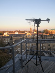
The only UK reciever still managing to recieve packets was the CUSF “trackotron” a computer controlled Yagi on a AZ/EL mount. With the elevation at 0′ the antenna was pointing horizontal towards the horizon, the last packet was recieved by CUSF at 18:18 at a range of 716km.

At this time a mad scramble to locate some hams in europe started. 2E0VIM and Darkside (sat at home in Australia!) started to use Globaltuners to recieve the signal as it slowly crossed germany. By this time word was getting out and DH1BDL started to decode packets which he posted to IRC and were uploaded manually.

Mean while in Skodstrup, Denmark a ham called OZ1SKY was trying to work out what the RTTY signal was on 434.635 he’d stumbled across. Realising it was RTTY but unable to decode it ( RX and TX were reversed) he was pointed in our direction and by about 19:40 we’d talked him through installing dl-fldigi and as Apex Alpha entered Poland we had reliable telemetry again.

With the temperature was dropping and with the temperature reporting -57’C the GPS started to drop out. For about 50 minutes the GPS was giving invalid information but the radio continued to transmit. At 21:34 the GPS sparked back into life reporting valid location information. With OZ1SKY being the only reciever attempts were made to locate some Polish hams but given the time we were unsucessful.

At 23:36, 775.6 km (50 baud RTTY record)  from the payload OZ1SKY recieved his last packet indicating the altitude was 36300 meters and that all systems were nominal. Its entirely likely the payload continued onwards across Poland and into the Ukraine as it left the range of our final tracker.

The current where abouts of the payload are unknown.

It was a great day and seemed to get quite a few people interested in what we do. Apex Alpha got on Hackaday and Slashdot. Congratulations to the Apex Alpha team and many thanks to all the regular recievers and the ones we picked up on the way!

Panoramas

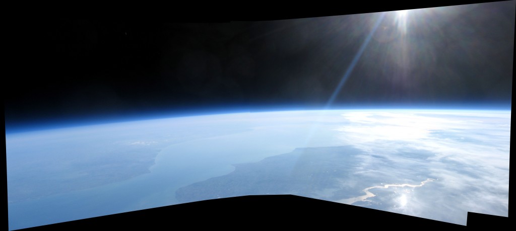
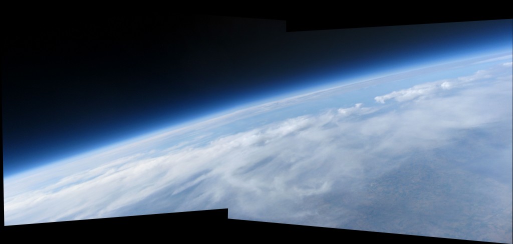
And the data keeps coming in. Thanks to Microsoft Image Composite Editor it means people with no skill like me can throw an assortment of images in to the program and result in stunning results like this :

This was two images joined together.

The above was 8 images combined together to give a view from Northern France across the channel to the South of England and in the bottom right the River Thames. Click for bigger. If you want to reuse these images please let me know.

TMSB/AVA Video by Josh

Josh Taylor has done a great video montage of all the footage acquired over the two days of the flight/recovery.

Check his blog out for more information :

Burst & Splash Down Videos

Data from video camera was recovered and it was running all the way down :

Also the burst was caught. Annoyingly the padding used to hold the camera in place looks like it was missing so field of view is obscured by the payload contained until burst when it righted itself :


Launch! Lost :( Found :) Recovered !

Been a very interesting 48 hours. Executive summary :

Ok lets start at the beginning. The plan was to do three launches from Elsworth near Cambridge on Saturday the 1st of October. the following payloads were planned to launch BELLO MONDO, XABEN and mine AVA. Having chatted with Steve (Rocketboy) it was decided AVA would take a passenger up underneath it, TMSB. TMSB had no radio telemetry in it but did have a commercial GSM tracker in it which would come in useful later…

It was a perfect day at the Elsworth site, we streamed the whole thing live via uStream so people could see what was going on whilst we prepared. MONDO launched first under a 2000g balloon then XABEN follow shortly afterwards. To ensure the TMSB payload didn’t damage AVA’s antenna we made a quick spacer using a cardboard roll, TMSB was attached via a carabiner under AVA.

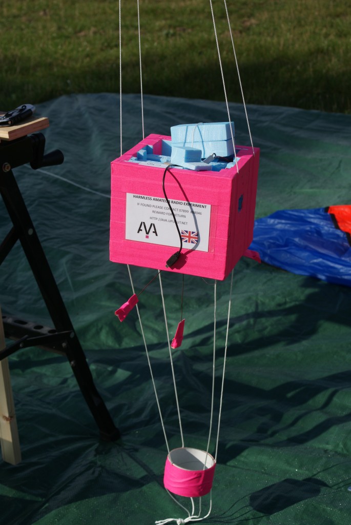
Had a few issues with the Canon A560 not initially powering up, it seemed when the card was set to write protect the camera wouldn’t power on. I have seen this before and its a damaged switch inside (annoying I only tested it yesterday). As a quick work around I booted it up in normal mode and initiated a firmware upgrade to get CHKD working. Once this was running I put the “bung” in the A/V socket to disable the screen and assembled the payload.

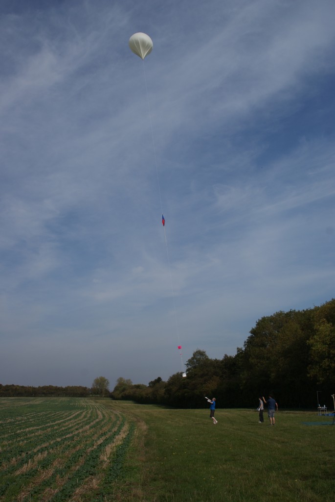
All assembled and balloon inflated it was go time, having not held one of these before I was genuinely surprised how much lift they generated, we’d put 3kg of lift on this one we slowly reeled it out until it floated off skywards :

We loaded the car up and set off in the general direction of the predicted landing zone near Thetford. It was quickly apparent something was amiss as AVA was reporting only 3 satellites and struggling to ascertain its location. This continued for about 20 mins until it lost all satellites and its location data. We continued onwards to the predicted landing site, it had a similar profile to XABEN so we decided to go collect that first.

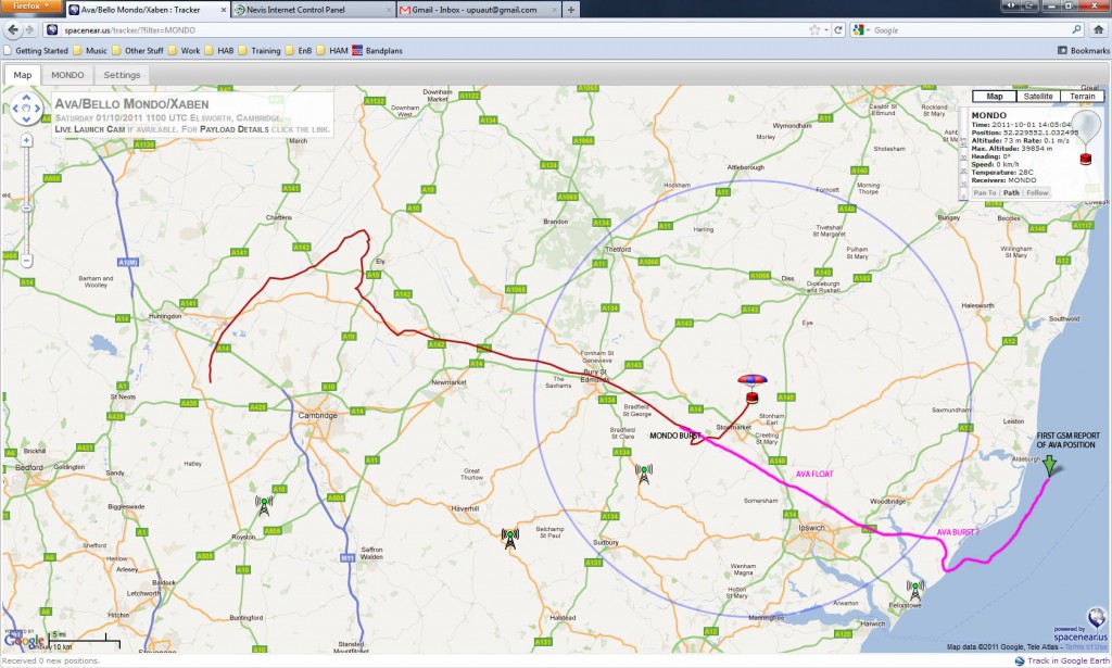
XABEN was located and recovered at which point we decided to break out the Yagi’s and triangulate AVA. The general direction was South East of us towards Lakenheath. Close to RAF Lakenheath the signal seemed very strong indeed down towards the horizon and we were convinced it was up a tree somewhere around there, we spent a good hour trying to zero in on but then the transmission suddenly ceased about 16:40.At this point the GSM tracker was reporting it was off the coast in the North sea, as this didn’t tally up with the predictions and was so much further than even MONDO had managed an hour or so earlier we initially discounted it as a dodgy reading.

After a quick telephone call with Steve we decided with no signal we’d just see if the GSM tracker settled down and gave a more accurate reading. Steve headed back off to Felixstowe and we headed back to the pub at Elsworth where Josh had parked his car. Over a pint of lemonade and some food we fired up the GSM tracker again and it was still reporting it was about 3-4 miles off the coast and moving slowly as if it was drifting.

It was fairly obvious our predictions had been wrong and two things had happened a) it had gone quite a bit higher than expected and/or b) it hadn’t burst when it was meant to and had gone into a float condition. Float condition is where the balloon stops at a certain altitude instead of bursting, it doesn’t go any higher but doesn’t come down either.Eventually as the U/V attacks the latex they will burst but this can take a while.

Given how far it had gone a float was the only real explanation and would also account for it being low on the horizon from Lakenheath. As it was getting dark and the location was a good 70 miles from Elsworth we decided there was little we could do today so called it a day and headed off home.

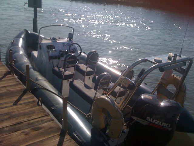
Sunday morning 8am. Josh sends me a text saying the payload was still reporting its location (about 5 miles out to sea now) but the battery was running low on the tracker. Also we only had one “on demand location request left”. Steve called the Coast Guard asking for advise who put us in touch with a local boat tour company. They agreed to go out and get it, Josh requested the last location we had and this was passed on to the boat team.

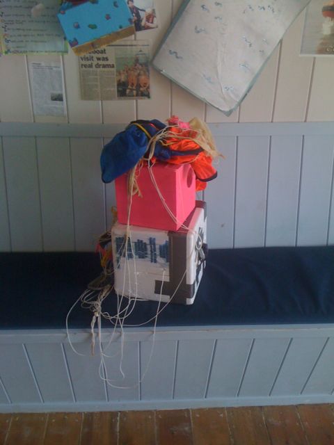
We knew something was up when the GSM tracker burst into life indicating it was doing 30mph back to shore! After a brief stop at the Coast Guard to be check for contraband it was handed over to Steve :

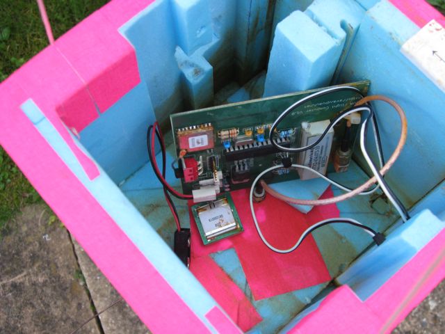
The AEE-MD91 camera was still powered up but everything else had died. Steve removed the SD Cards and put them in fresh water to remove the salt and then let the dry a bit. The inside of Ava looks to have some corrosion due to the salt water and batteries probably :

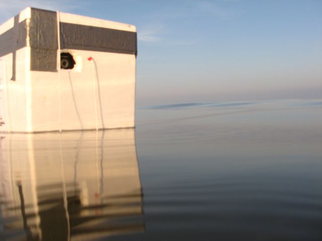
Steve then popped the SD Card into his PC to see if there was anything on it, oh boy no less than 2800 pictures! The camera was taking 1 picture every 10 seconds so this means it was active for at least 7 1/2 hours ( Canon A560 screen off/flash disabled Energizer Ultimate Lithium’s packet says up to 680 pictures – HAHA). One of the first pictures off was AVA taking a picture of the TMSB payload in the water next to it :

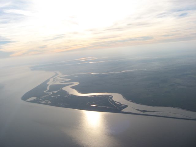
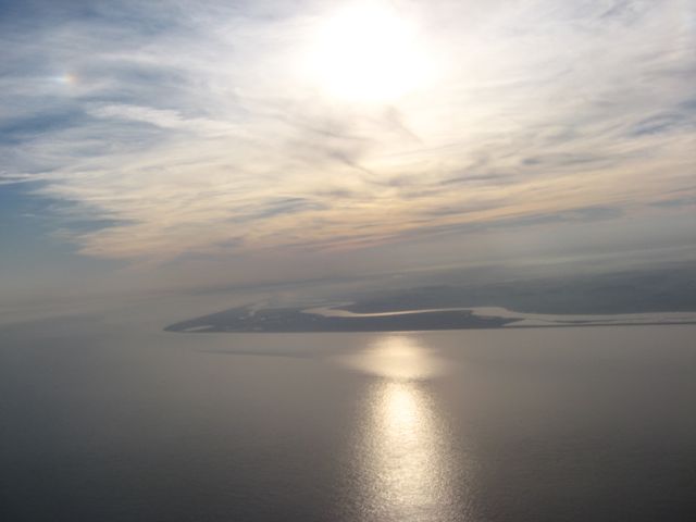
Amazing how calm the water was a few really nice pictures followed from the decent :

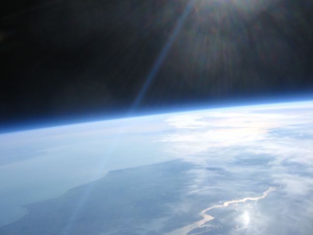
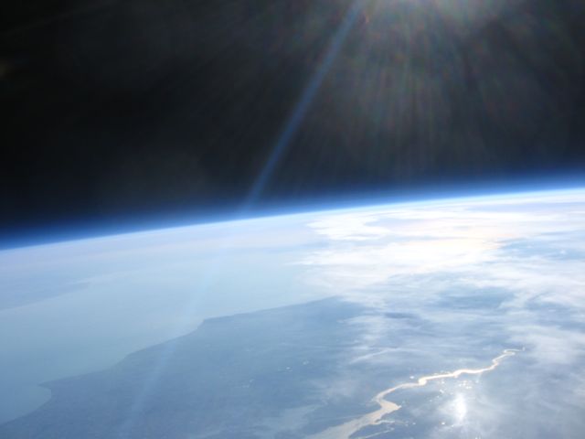
Then my favourite :

That’s the river Thames with France in the distance somewhere around 34-36km high.

Over the next few days I hope to get the SD cards back to have a good look through all the photos, 1/3 of them are black as the payload was taking pictures well into the night.

Having reviewed the data the take off was 12:45 and the landing was at 16:41 giving a flight time of flight time of just short of 4 hours. Final altitude was most likely 36km, Steve advised the GPS antenna was slightly damaged, I don’t know if we caught it when we assembled the payload.

Probable track was :

I’d like to say a massive thanks to all the team at UKHAS ( http://ukhas.org.uk ) for taking the time to track AVA even though it wasn’t transmitting its location correctly. Thanks to Josh & Ed without whom I wouldn’t be seeing these pictures now. And finally a huge huge thank you to Steve Randall of Random Engineering for all the effort put in on Saturday and today to get the payloads recovered.

Update1 : Launch Pictures here : https://picasaweb.google.com/118244444241111963790/201110AvaLaunch

Update2 : Josh confirms all his cameras working and data recovered.

Update3 : GSM Tracker used was supplied by http://www.trackershop-uk.com/ I doubt they designed it to float in the North Sea for 16 hours but it performed admirably.

Update 4 : Having reviewed video footage burst was at 15:54:37, splash down was at 16:43:30 50 mins later.

Pyro Test 2 – Match Stick Pyro

Out of interest I decided to see if could replace the hard(er) to get smokeless powder with something more readily attainable. I’ve always had a fascination with matches so I bought a box from Tescos. After carefully scraping the heads off about 1/2 a box and then crushing them with a spoon (be careful they will ignite, so very small quanties and wear gloves and eye protection).

I packed a acrylic tube with the pink powder and sealed the end with epoxy. After 10 mins I hung it up and did a test fire :


Bit of a result.

Situationally aware flight computer

Now we have the cut downs the flight computer needs to be aware of what its current status is. Traditionally the criteria for triggering a flight termination is exceeding a set altitude or leaving a certain geographic area.

I felt neither of these are suitable, instead I wanted to terminate the flight based on the current rate of ascent. I quickly coded up some current rate of ascent calculations so the payload knows what its current vertical rate is.

Based on this vertical rate it makes decisions about whether its Ascending, Decending, Floating or it has a leak.

Ascent is defined by a Rate of Ascent (RoA) >1 m/s
Descent is defined by a RoA < -2 m/s
Float is defined by a RoA between -1 and 1 m/s
Leak is defined by a RoA < 0 but > -2 m/s

As a test I intend to fly the payload without a pyro but leave this code in so I can see what the payload thinks its RoA is and what decisions it takes based on this information. I’ve introduced a flight status code as follows :

A = Ascending – Nominal Flight
D = Decending – Nominal Flight
L = Leak Condition Detected
F = Float Condition Detected
P = Pyro fired due to decent detection (i.e balloon has burst)
Q = Pyro fired due to detection of a float condition.
R = Pyro fired due to detection of a leak condition.
G = Ground mode prior to launch.
S = Landing mode (this is set when decending and altitude drops below 500m – possibly trigger siren or somthing)
N = No GPS lock

Pyro Cut downs

Having watched a few flights lately I’m determined not to loose a payload as the balloon floats or leaks etc. To this end I needed some way of terminating the flight automomously should it stray out of certain preset conditions. The flight termination is done by some sort of cut down so the balloon is severed from the payload/parachute assembly. I’ve tried a nichrome but down before but they are slow and mechanically fragile (at least the ones I’ve made were).

The pyrotechnic cutdowns seem a better idea using a small rocket motor igniter and a gram or two of smokeless powder. I made a few up today and tested one in the garden :

Also see this post : http://ava.upuaut.net/?p=149 for a version using match sticks instead of gun powder!

Launch Postponed

Well we had the NOTAM, we had the kit but unfortunately the weather wasn’t in our favour. We decided on balance it would be better to abort the launch than risk landing on Leeds ! Some last minute testing on before our posponed revealed some rather catastrophic errors in the code that would have generated some real issues.

Having run some live data through a GPS simulator and fed it into the code it became rapidly apparent I havd a very bad case of padding bugs. I re-wrote the whole thing and did the work in integer space instead as floating point to string sucks on Arduinos.

I have reapplied for a NOTAM so watch this space!

Provisional Launch Date!

Got the Parachutes back with their balloon attachments (Thanks Stitchy Buckle in Bingley this was one of the stranger alterations they’ve done  !).

With the NOTAM looking promising I’m please to announce the provisional first launch of Ava will be at this years Deershed Festival. Fitting in with their science theme of the Sky at Night hopefully we will provide some impressive pictures of the Sky in the day as well!

Our provisional launch date is Sunday the 24th in the morning. This is of course subject to weather and the NOTAM being approved. Further details to follow. Why not get some tickets to the festival and come and see some great bands and a HAB launch at the same time !